Geolocate

Milwaukee topographic map

Click on the map to display elevation.

About this map
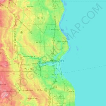
Name: Milwaukee topographic map, elevation, terrain.

Location: Milwaukee, Milwaukee County, Wisconsin, United States (42.92082 -88.07106 43.19494 -87.86271)

Average elevation: 202 m

Minimum elevation: 171 m

Maximum elevation: 293 m

Other topographic maps

Click on a map to view its topography, its elevation and its terrain.
Gear up for your next adventure:

🕯️Camping Lantern - Illuminates your entire campsite with high-efficiency LEDs
🥾Approach Shoes - Shoes designed for climbing approaches and rugged trails
🌡️Emergency Mylar Blankets - Compact thermal protection for unexpected nights outdoors
🧴First Aid Kit - Essential first aid supplies for outdoor emergencies
🧥Waterproof Jacket - Lightweight rain jackets for hiking and outdoor activities

As an Amazon Associate, this site earns from qualifying purchases at no extra cost to you.