Geolocate

Balodabazar topographic map

Click on the map to display elevation.

Balodabazar

Baloda Bazar is located at 30°40′N 82°10′E / 30.67°N 82.17°E / 30.67; 82.17. It has an average elevation of 254 m (833 ft). There are several tourist places in Balodabazaar like Sirpur, Turturia, Giroudpuri, Siddheswr Mandir Pallari and many more.

Wikipedia (CC-BY-SA 3.0)

About this map

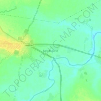
Name: Balodabazar topographic map, elevation, terrain.

Location: Balodabazar, Baloda Bazar Tahsil, Baloda Bazar, Chhattisgarh, 495559, India (21.61647 82.12060 21.69647 82.20060)

Average elevation: 251 m

Minimum elevation: 236 m

Maximum elevation: 271 m

Gear up for your next adventure:

👟Leg Gaiters - Keep debris, mud, and snow out of your boots
🎒Hiking Daypack - Lightweight and durable backpacks for day trips and excursions
🔦LED Headlamp - Hands-free lighting for early morning starts or late finishes
💡Compact LED Flashlight - Powerful and portable flashlight for outdoor use
🧭GPS Outdoor Watch - Smart watch for navigation and fitness tracking in nature

As an Amazon Associate, this site earns from qualifying purchases at no extra cost to you.