Geolocate

Mount Pleasant topographic map

Click on the map to display elevation.

About this map
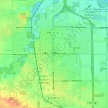
Name: Mount Pleasant topographic map, elevation, terrain.

Location: Mount Pleasant, Isabella County, Michigan, United States (43.56794 -84.80282 43.62647 -84.73789)

Average elevation: 237 m

Minimum elevation: 222 m

Maximum elevation: 262 m

Other topographic maps

Click on a map to view its topography, its elevation and its terrain.

Gear up for your next adventure:

👖Convertible Hiking Pants - Zip-off legs to adapt to changing weather conditions
🥾Trail Hiking Socks - Comfortable socks to prevent blisters and fatigue
🛶Waterproof Dry Bags - Keep electronics and clothes dry during river crossings
🧤Insulated Winter Gloves - Heavy-duty protection for sub-zero Canadian adventures
🧥Softshell Hiking Jacket - The perfect balance of wind protection and breathability

As an Amazon Associate, this site earns from qualifying purchases at no extra cost to you.