Geolocate

Plauen topographic map

Click on the map to display elevation.

About this map

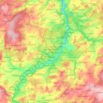
Name: Plauen topographic map, elevation, terrain.

Location: Plauen, Vogtlandkreis, Saxony, Germany (50.43067 12.05941 50.57488 12.22946)

Average elevation: 429 m

Minimum elevation: 300 m

Maximum elevation: 553 m

Gear up for your next adventure:

🔥Camping Stove - Portable stoves to cook outdoors with ease
🎒Fully Waterproof Backpack - Total protection for photography gear and electronics
🧣Merino Neck Gaiter - Protects against wind, sun, and cold at high altitudes
🧢Sun Hat - Wide-brim hat for sun protection
🥾Hiking Shoes - Durable and comfortable shoes for trail hiking

As an Amazon Associate, this site earns from qualifying purchases at no extra cost to you.