Geolocate

Hydra topographic map

Click on the map to display elevation.

About this map
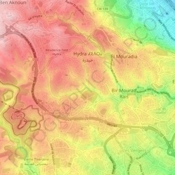
Name: Hydra topographic map, elevation, terrain.

Location: Hydra, Bir Mourad Rais District, Algiers, Algeria (36.72426 3.00151 36.75709 3.04928)

Average elevation: 161 m

Minimum elevation: 1 m

Maximum elevation: 260 m

Other topographic maps

Click on a map to view its topography, its elevation and its terrain.

Meridja

Algeria > Algiers > Bir Mourad Rais District

Average elevation: 113 m

Gear up for your next adventure:

🦶Anti-Blister Balm - Prevents friction and hotspots during long ascents
🥾Hiking Gaiters - Protect legs and shoes from mud, snow, and debris
🔥Emergency Fire Starter - Reliable ignition source for all weather conditions
🥾Light Hiking Boots - Lightweight and comfortable boots for day hikes
🥾Mountain Hiking Boots - High-traction boots for rocky terrain

As an Amazon Associate, this site earns from qualifying purchases at no extra cost to you.