Geolocate

Flåm topographic map

Click on the map to display elevation.

About this map

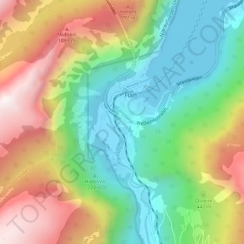
Name: Flåm topographic map, elevation, terrain.

Location: Flåm, Aurland, Vestland, 5742, Norway (60.83794 7.09075 60.87794 7.13075)

Average elevation: 488 m

Minimum elevation: -1 m

Maximum elevation: 1,296 m

Gear up for your next adventure:

🥾All-Terrain Hiking Boots - Versatile boots for varied hiking conditions
Bushcraft Tarp - Versatile emergency shelter or gear protection
🪑Ultralight Camping Stool - Compact seating for rest stops during long hikes
🧦Crew Hiking Socks - Comfortable socks for long-distance hikes
🧥Softshell Jacket - Windproof and breathable jacket for hiking

As an Amazon Associate, this site earns from qualifying purchases at no extra cost to you.