Geolocate

Le Diaka topographic map

Click on the map to display elevation.

About this map

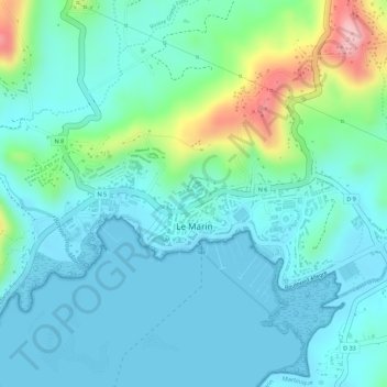
Name: Le Diaka topographic map, elevation, terrain.

Location: Le Diaka, Le Marin, Martinique, 97290, France (14.46336 -60.88026 14.48336 -60.86026)

Average elevation: 38 m

Minimum elevation: -1 m

Maximum elevation: 172 m

Gear up for your next adventure:

💧Reusable Water Bottle - Durable water bottles for hydration on trails
🥾Trail Running Shoes - Lightweight and durable shoes for trail running
🥾Hiking Gaiters - Protect legs and shoes from mud, snow, and debris
🧣Evaporative Cooling Towel - Beat the heat during intense summer climbs
🚲MTB Frame Bag - Carry tools and maps directly on your bicycle frame

As an Amazon Associate, this site earns from qualifying purchases at no extra cost to you.