Geolocate

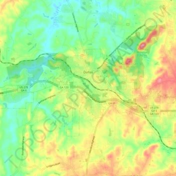
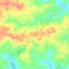
Dallas topographic map

Click on the map to display elevation.

Dallas

Dallas is part of the Deep South cultural and geographic subregion. The city has an elevation of 1,043 feet (318 m), which makes it one of the highest elevation suburban cities in the Atlanta metropolitan area. Dallas is also a part of the physiographic region of the greater Appalachian Mountains.

Wikipedia (CC-BY-SA 3.0)

About this map

Name: Dallas topographic map, elevation, terrain.

Location: Dallas, Paulding County, Georgia, United States (33.88875 -84.89893 33.94127 -84.78327)

Average elevation: 307 m

Minimum elevation: 252 m

Maximum elevation: 386 m

Other topographic maps

Click on a map to view its topography, its elevation and its terrain.
Yorkville

United States > Georgia > Paulding County

Average elevation: 393 m

Pumpkin

United States > Georgia > Paulding County

Average elevation: 300 m

Ray Mountain

United States > Georgia > Paulding County

Average elevation: 306 m

Ash

United States > Georgia > Paulding County

Average elevation: 319 m

Nebo

United States > Georgia > Paulding County > Hiram

Average elevation: 317 m

Gear up for your next adventure:

🚑Survival Whistle - Signal for help across long distances in mountains
🚲Heavy Duty Bike Lock - Secure your bike at the trailhead or during stops
🧥Packable Rain Jacket - Breathable waterproof layer for unpredictable weather
🏃Hydration Running Vest - Carry water and maps close to your body for speed
⛺Camping Groundsheet - Protect your tent from moisture and dirt

As an Amazon Associate, this site earns from qualifying purchases at no extra cost to you.