Geolocate

Kirchheim topographic map

Click on the map to display elevation.

About this map
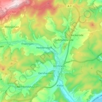
Name: Kirchheim topographic map, elevation, terrain.

Location: Kirchheim, Landkreis Hersfeld-Rotenburg, Hesse, 36275, Germany (50.80734 9.49479 50.89058 9.63022)

Average elevation: 357 m

Minimum elevation: 206 m

Maximum elevation: 635 m

Gear up for your next adventure:

🥤Collapsible Travel Cup - Saves space and weight in your mess kit
💧Filtered Water Bottle - Safe drinking water on the go
🚲MTB Frame Bag - Carry tools and maps directly on your bicycle frame
🧥Softshell Hiking Jacket - The perfect balance of wind protection and breathability
🛁Quick-Dry Microfiber Towel - Space-saving towel that dries rapidly on the move

As an Amazon Associate, this site earns from qualifying purchases at no extra cost to you.