Geolocate

Atherstone topographic map

Click on the map to display elevation.

About this map
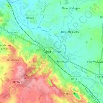
Name: Atherstone topographic map, elevation, terrain.

Location: Atherstone, North Warwickshire, Warwickshire, England, CV9 1JN, United Kingdom (52.53724 -1.58340 52.61724 -1.50340)

Average elevation: 101 m

Minimum elevation: 63 m

Maximum elevation: 182 m

Other topographic maps

Click on a map to view its topography, its elevation and its terrain.
Gear up for your next adventure:

🧴Waterproofing Spray - Restore the DWR coating on jackets and tents
🛌Insulated Sleeping Pad - Critical thermal barrier between you and the cold ground
❄️Traction Ice Cleats - Slip-on spikes for icy trails and winter hiking
🥾Hiking Shoes - Durable and comfortable shoes for trail hiking
🧥Fleece Jacket - Warm and lightweight jacket for layering

As an Amazon Associate, this site earns from qualifying purchases at no extra cost to you.