Geolocate

Kettle River topographic map

Click on the map to display elevation.

About this map

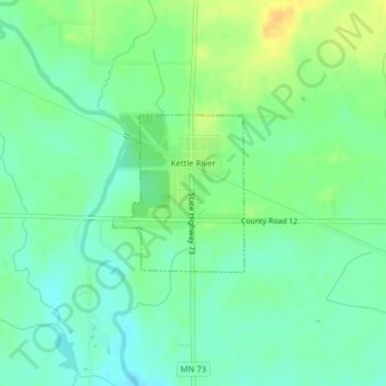
Name: Kettle River topographic map, elevation, terrain.

Location: Kettle River, Carlton County, Minnesota, United States (46.48076 -92.88553 46.49177 -92.87213)

Average elevation: 356 m

Minimum elevation: 345 m

Maximum elevation: 372 m

Other topographic maps

Click on a map to view its topography, its elevation and its terrain.

Sawyer

United States > Minnesota > Carlton County > North Carlton

Average elevation: 399 m

Gear up for your next adventure:

🦟Insect Repellent - Keep mosquitoes and black flies away in wooded areas
🚲Bike Repair Kit - Essential tools for on-trail mechanical issues
🧤Thermal Hiking Gloves - Grip-enhanced gloves for cold-weather altitude trekking
Camping Groundsheet - Protect your tent from moisture and dirt
🔭Compact Monocular - One-handed bird watching and trail spotting

As an Amazon Associate, this site earns from qualifying purchases at no extra cost to you.