Geolocate

Crystal Lake topographic map

Click on the map to display elevation.

About this map

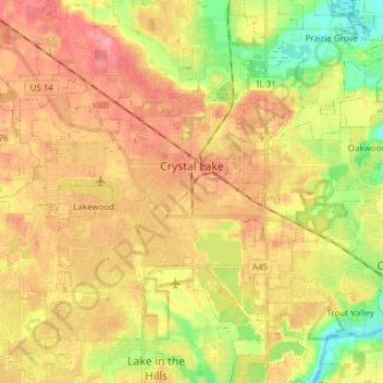
Name: Crystal Lake topographic map, elevation, terrain.

Location: Crystal Lake, McHenry County, Illinois, 60014, United States (42.19006 -88.42330 42.27694 -88.27181)

Average elevation: 267 m

Minimum elevation: 222 m

Maximum elevation: 302 m

Other topographic maps

Click on a map to view its topography, its elevation and its terrain.

6316

United States > Illinois > McHenry County > Ringwood

Average elevation: 244 m

Riley

United States > Illinois > McHenry County

Riley, elevation 807 feet (246 m), is an unincorporated community and census-designated place in McHenry County, Illinois, United States. It was named a CDP before the 2020 census, at which time it had a population of 10.

Average elevation: 250 m

Coral

United States > Illinois > McHenry County > Coral

Average elevation: 271 m

Burtons Bridge

United States > Illinois > McHenry County

Average elevation: 231 m

Gear up for your next adventure:

🔭Compact Monocular - One-handed bird watching and trail spotting
🚲Heavy Duty Bike Lock - Secure your bike at the trailhead or during stops
🧊Insulated Water Bottle - Keeps drinks cold in summer and prevents freezing in winter
🎒Backpack Rain Cover - External shield to keep your entire pack dry
🕶️Polarized Sunglasses - Protect your eyes with durable polarized lenses

As an Amazon Associate, this site earns from qualifying purchases at no extra cost to you.