Geolocate

Pedroso topographic map

Click on the map to display elevation.

About this map

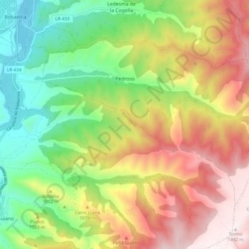
Name: Pedroso topographic map, elevation, terrain.

Location: Pedroso, Rioja, Spain (42.26301 -2.74969 42.31176 -2.65563)

Average elevation: 954 m

Minimum elevation: 553 m

Maximum elevation: 1,445 m

Gear up for your next adventure:

🔥Emergency Fire Starter - Reliable ignition source for all weather conditions
🥾Trekking Boots - Durable boots for long-distance trekking
🧴First Aid Kit - Essential first aid supplies for outdoor emergencies
Bushcraft Tarp - Versatile emergency shelter or gear protection
🧥Thermal Layer - Insulating layer for cold outdoor conditions

As an Amazon Associate, this site earns from qualifying purchases at no extra cost to you.