
Thank you for supporting this site ❤️
Make a donation
Make a donation
Gear up for your next adventure:
As an Amazon Associate, this site earns from qualifying purchases at no extra cost to you.
刀坝 topographic map
Click on the map to display elevation.
Thank you for supporting this site ❤️
Make a donation
Make a donation
Gear up for your next adventure:
As an Amazon Associate, this site earns from qualifying purchases at no extra cost to you.
About this map
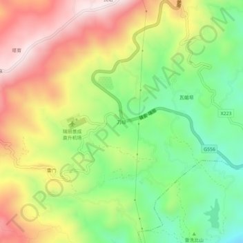
Name: 刀坝 topographic map, elevation, terrain.
Location: 刀坝, 勐秀乡, 瑞丽市, 德宏傣族景颇族自治州, 云南省, 665000, 中国 (24.04730 97.80462 24.08730 97.84462)
Average elevation: 1,146 m
Minimum elevation: 883 m
Maximum elevation: 1,448 m
Thank you for supporting this site ❤️
Make a donation
Make a donation
Gear up for your next adventure:
As an Amazon Associate, this site earns from qualifying purchases at no extra cost to you.