Geolocate

Boardman topographic map

Click on the map to display elevation.

About this map

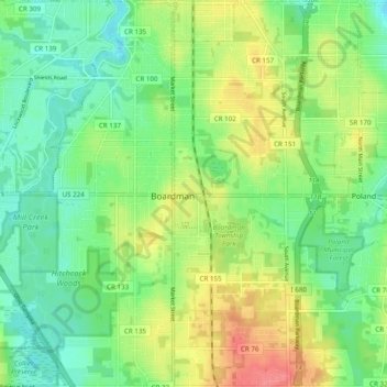
Name: Boardman topographic map, elevation, terrain.

Location: Boardman, Mahoning County, Ohio, 44512, United States (40.98791 -80.71127 41.06127 -80.61563)

Average elevation: 323 m

Minimum elevation: 295 m

Maximum elevation: 366 m

Gear up for your next adventure:

🪑Insulated Seat Pad - Protect your seat from cold rocks and wet logs
🥾Durable Hiking Shoes - Long-lasting shoes for frequent hiking
🔋Lithium AA Batteries - Long-lasting power that performs in extreme cold
🦟Insect Repellent - Keep mosquitoes and black flies away in wooded areas
🧳Compression Sacks - Maximize space in your backpack by shrinking gear

As an Amazon Associate, this site earns from qualifying purchases at no extra cost to you.