Geolocate

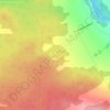
Courcelles–Saint-Évariste topographic map

Click on the map to display elevation.

About this map

Name: Courcelles–Saint-Évariste topographic map, elevation, terrain.

Location: Courcelles–Saint-Évariste, Beauce-Sartigan, Chaudière-Appalaches, Québec, Canada (45.83530 -71.10680 46.00635 -70.85719)

Average elevation: 369 m

Minimum elevation: 246 m

Maximum elevation: 504 m

Other topographic maps

Click on a map to view its topography, its elevation and its terrain.

Saint-Georges

Canada > Québec > Beauce-Sartigan

Average elevation: 308 m

Lac Wilson

Canada > Québec > Beauce-Sartigan > Saint-Théophile

Average elevation: 510 m

Armstrong

Canada > Québec > Beauce-Sartigan > Saint-Théophile

Average elevation: 591 m

Gear up for your next adventure:

🥫Freeze-Dried Meals - Lightweight, high-calorie nutrition for multi-day treks
🥾Approach Boots - Comfortable boots for hiking and climbing approaches
🥾Approach Shoes - Shoes designed for climbing approaches and rugged trails
🧦Merino Wool Socks - Moisture-wicking comfort for long-distance hiking
🧴First Aid Kit - Essential first aid supplies for outdoor emergencies

As an Amazon Associate, this site earns from qualifying purchases at no extra cost to you.