
Thank you for supporting this site ❤️
Make a donation
Make a donation
Gear up for your next adventure:
As an Amazon Associate, this site earns from qualifying purchases at no extra cost to you.
吾竹 topographic map
Click on the map to display elevation.
Thank you for supporting this site ❤️
Make a donation
Make a donation
Gear up for your next adventure:
As an Amazon Associate, this site earns from qualifying purchases at no extra cost to you.
About this map
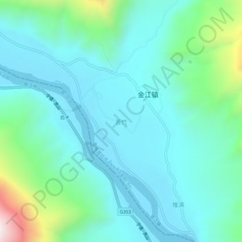
Name: 吾竹 topographic map, elevation, terrain.
Location: 吾竹, 金江镇, 香格里拉市, 迪庆藏族自治州, 云南省, 中国 (27.13067 99.81261 27.17067 99.85261)
Average elevation: 2,009 m
Minimum elevation: 1,838 m
Maximum elevation: 2,739 m
Thank you for supporting this site ❤️
Make a donation
Make a donation
Gear up for your next adventure:
As an Amazon Associate, this site earns from qualifying purchases at no extra cost to you.