Geolocate

Haubourdin topographic map

Click on the map to display elevation.

About this map
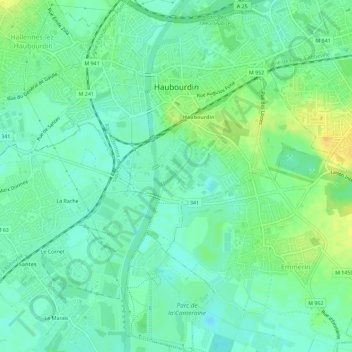
Name: Haubourdin topographic map, elevation, terrain.

Location: Haubourdin, Lille, Nord, Hauts-de-France, Metropolitan France, 59320, France (50.58208 2.96711 50.61824 3.01156)

Average elevation: 25 m

Minimum elevation: 15 m

Maximum elevation: 40 m

Other topographic maps

Click on a map to view its topography, its elevation and its terrain.
Arenberg

France > Hauts-de-France > Nord > Wallers

Average elevation: 31 m

Mouvaux

France > Hauts-de-France > Nord > Mouvaux > Mouvaux

Average elevation: 35 m

Gear up for your next adventure:

⛺Camping Tent - Weather-resistant tents suitable for 2 to 6 people
💧Hydration Bladder - Hands-free hydration solution for long treks
🐕Hiking Dog Pack - Let your canine companion carry their own water and food
🩹Compact First Aid Kit - Pre-packed essentials for common trail injuries
🔭Outdoor Binoculars - Lightweight binoculars for birdwatching and hiking

As an Amazon Associate, this site earns from qualifying purchases at no extra cost to you.