Geolocate

Montecastello topographic map

Click on the map to display elevation.

About this map

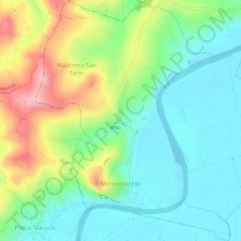
Name: Montecastello topographic map, elevation, terrain.

Location: Montecastello, Alessandria, Piedmont, Italy (44.94209 8.67018 44.97303 8.71349)

Average elevation: 134 m

Minimum elevation: 77 m

Maximum elevation: 248 m

Other topographic maps

Click on a map to view its topography, its elevation and its terrain.

Spinetta Marengo

Italy > Piedmont > Alessandria > Alessandria

Average elevation: 98 m

Gear up for your next adventure:

🔦LED Headtorch - Bright and durable light for night activities
❄️Traction Ice Cleats - Slip-on spikes for icy trails and winter hiking
Lightweight Camping Tent - Portable shelter optimized for Canadian backcountry camping
🧭GPS Tracker - Track your location in remote areas safely
🧥Thermal Fleece Jacket - Versatile insulation for changing mountain temperatures

As an Amazon Associate, this site earns from qualifying purchases at no extra cost to you.