Geolocate

Irving topographic map

Click on the map to display elevation.

About this map

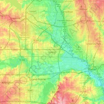
Name: Irving topographic map, elevation, terrain.

Location: Irving, Dallas County, Texas, 75061, United States (32.66952 -97.10422 32.98952 -96.78422)

Average elevation: 162 m

Minimum elevation: 117 m

Maximum elevation: 233 m

Gear up for your next adventure:

🧰Multitool Knife - Compact and versatile tool for outdoor use
🥾Trail Hiking Boots - Supportive boots for rough trails
🥾Trail Hiking Socks - Comfortable socks to prevent blisters and fatigue
🧣Evaporative Cooling Towel - Beat the heat during intense summer climbs
Camping Coffee Maker - Brew fresh coffee anywhere on the topographic map

As an Amazon Associate, this site earns from qualifying purchases at no extra cost to you.