Geolocate

Löbau topographic map

Click on the map to display elevation.

About this map

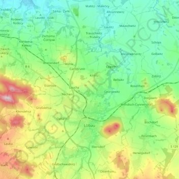
Name: Löbau topographic map, elevation, terrain.

Location: Löbau, Görlitz - Zhorjelc, Saxony, 02708, Germany (51.05544 14.59418 51.18607 14.75638)

Average elevation: 273 m

Minimum elevation: 159 m

Maximum elevation: 529 m

Gear up for your next adventure:

🔋Emergency Crank Radio - Weather alerts and power without needing batteries
🥾Lightweight Hiking Shoes - Comfortable shoes for day hikes
👖Convertible Hiking Pants - Zip-off legs to adapt to changing weather conditions
🧦Merino Wool Socks - Moisture-wicking comfort for long-distance hiking
💡LED Headlamp - Hands-free illumination for night hiking and camping

As an Amazon Associate, this site earns from qualifying purchases at no extra cost to you.