Geolocate

Thedford topographic map

Click on the map to display elevation.

About this map

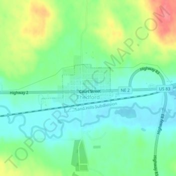
Name: Thedford topographic map, elevation, terrain.

Location: Thedford, Thomas County, Nebraska, 69166, United States (41.97520 -100.58387 41.98256 -100.56955)

Average elevation: 886 m

Minimum elevation: 861 m

Maximum elevation: 935 m

Gear up for your next adventure:

❄️Traction Ice Cleats - Slip-on spikes for icy trails and winter hiking
🩹Compact First Aid Kit - Pre-packed essentials for common trail injuries
💡LED Camping Lantern - Illuminate your campsite with long-lasting lanterns
🥾Hiking Leggings - Comfortable leggings for outdoor activities
🧴Insect Repellent - Protect yourself from bugs during outdoor adventures

As an Amazon Associate, this site earns from qualifying purchases at no extra cost to you.