Geolocate

Alford topographic map

Click on the map to display elevation.

About this map

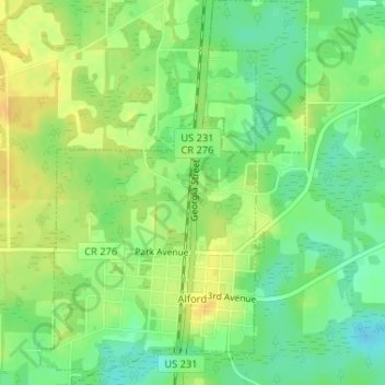
Name: Alford topographic map, elevation, terrain.

Location: Alford, Jackson County, Florida, United States (30.68740 -85.40473 30.71533 -85.38223)

Average elevation: 42 m

Minimum elevation: 27 m

Maximum elevation: 56 m

Gear up for your next adventure:

🎒Fully Waterproof Backpack - Total protection for photography gear and electronics
🔭Outdoor Binoculars - Lightweight binoculars for birdwatching and hiking
🧥Ultralight Puffy Jacket - Maximum warmth that packs down to the size of an orange
🪜Heavy Duty Carabiners - Multi-use clips for securing gear to your backpack
🦶Hiking Shoe Insoles - Added support for high arches and long days on feet

As an Amazon Associate, this site earns from qualifying purchases at no extra cost to you.