Geolocate

Dalmine topographic map

Click on the map to display elevation.

About this map

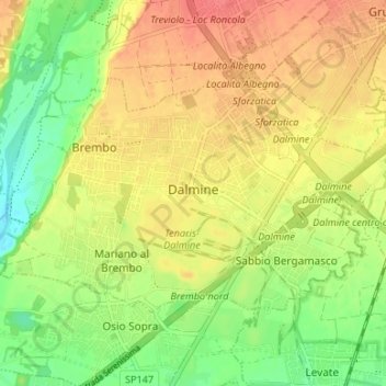
Name: Dalmine topographic map, elevation, terrain.

Location: Dalmine, Bergamo, Lombardy, 24044, Italy (45.63235 9.56598 45.66118 9.63250)

Average elevation: 201 m

Minimum elevation: 173 m

Maximum elevation: 228 m

Other topographic maps

Click on a map to view its topography, its elevation and its terrain.

Valpiana

Italy > Lombardy > Bergamo

Average elevation: 1,106 m

Gear up for your next adventure:

🥾Mountaineering Boots - Supportive boots for climbing and high-altitude hiking
🐕Hiking Dog Pack - Let your canine companion carry their own water and food
🥽Outdoor Goggles - Protective eyewear for outdoor activities
🛰️Satellite Messenger - Emergency communication for areas with no cell service
🪑Insulated Seat Pad - Protect your seat from cold rocks and wet logs

As an Amazon Associate, this site earns from qualifying purchases at no extra cost to you.