Geolocate

Clinton topographic map

Click on the map to display elevation.

About this map
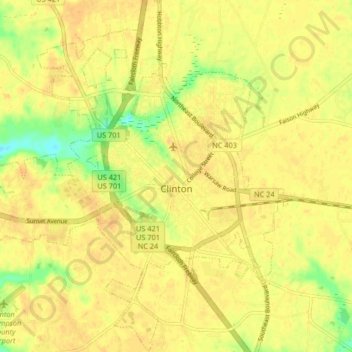
Name: Clinton topographic map, elevation, terrain.

Location: Clinton, Sampson County, North Carolina, United States (34.96663 -78.37490 35.03406 -78.29713)

Average elevation: 46 m

Minimum elevation: 24 m

Maximum elevation: 55 m

Gear up for your next adventure:

🪑Insulated Seat Pad - Protect your seat from cold rocks and wet logs
💧Collapsible Water Bottle - Space-saving water bottle for outdoor activities
🥾Trail Running Shoes - Lightweight and durable shoes for trail running
🔦LED Flashlight - Powerful and long-lasting flashlight for camping and emergencies
🎒Fully Waterproof Backpack - Total protection for photography gear and electronics

As an Amazon Associate, this site earns from qualifying purchases at no extra cost to you.