Geolocate

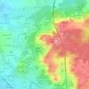
Saint-Mars-la-Brière topographic map

Click on the map to display elevation.

About this map

Name: Saint-Mars-la-Brière topographic map, elevation, terrain.

Location: Saint-Mars-la-Brière, Mamers, Sarthe, Pays de la Loire, Metropolitan France, 72470, France (47.97642 0.34131 48.07671 0.42416)

Average elevation: 74 m

Minimum elevation: 47 m

Maximum elevation: 139 m

Other topographic maps

Click on a map to view its topography, its elevation and its terrain.

Pontenchéri

France > Pays de la Loire > Sarthe > Courdemanche

Average elevation: 112 m

L'Armenaudière

France > Pays de la Loire > Sarthe > Écommoy

Average elevation: 116 m

La Thibaudière

France > Pays de la Loire > Sarthe > Arçonnay

Average elevation: 158 m

Gear up for your next adventure:

🔪Outdoor Multitool - Versatile tool for repairs and food prep in the wild
💧Hydration Bladder - Hands-free hydration solution for long treks
🧢Beanie Hat - Keep your head warm in cold weather
🧥Fleece Jacket - Warm and lightweight jacket for layering
🥾Approach Shoes - Shoes designed for climbing approaches and rugged trails

As an Amazon Associate, this site earns from qualifying purchases at no extra cost to you.