
Peñaflor topographic map
Click on the map to display elevation.
About this map
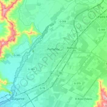
Name: Peñaflor topographic map, elevation, terrain.
Average elevation: 425 m
Minimum elevation: 310 m
Maximum elevation: 920 m
Other topographic maps
Click on a map to view its topography, its elevation and its terrain.
El Curato Oriente
Chile > Santiago Metropolitan Region > Provincia de Talagante
Average elevation: 438 m
El Peumo
Chile > Santiago Metropolitan Region > Provincia de Talagante > Talagante
Average elevation: 324 m
Santa Mónica Norte
Chile > Santiago Metropolitan Region > Provincia de Talagante
Average elevation: 487 m