
Arak topographic map
Click on the map to display elevation.
Arak
Arak is surrounded by mountains in the south, west, and east, and its average altitude is about 1750m above sea level. It is located 260 km from the city of Tehran, and is in the vicinity of the cities of Qom and Isfahan.
About this map
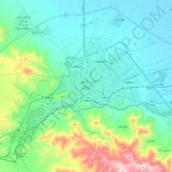
Name: Arak topographic map, elevation, terrain.
Location: Arak, بخش مرکزی, Arak County, Markazi Province, Iran (34.04294 49.60821 34.13117 49.79708)
Average elevation: 1,871 m
Minimum elevation: 1,669 m
Maximum elevation: 2,616 m
Other topographic maps
Click on a map to view its topography, its elevation and its terrain.