Geolocate

Chiatona topographic map

Click on the map to display elevation.

About this map

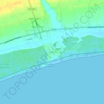
Name: Chiatona topographic map, elevation, terrain.

Location: Chiatona, Palagiano, Taranto, Apulia, Italy (40.50082 17.04066 40.54082 17.08066)

Average elevation: 5 m

Minimum elevation: -2 m

Maximum elevation: 25 m

Gear up for your next adventure:

🔨Vehicle Emergency Tool - Safety tool for remote road trips to trailheads
🧣Evaporative Cooling Towel - Beat the heat during intense summer climbs
Camping Coffee Maker - Brew fresh coffee anywhere on the topographic map
Lightweight Backpacking Tent - Compact tent for efficient hiking trips
🧣Merino Neck Gaiter - Protects against wind, sun, and cold at high altitudes

As an Amazon Associate, this site earns from qualifying purchases at no extra cost to you.