Geolocate

West Down topographic map

Click on the map to display elevation.

About this map

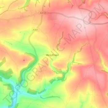
Name: West Down topographic map, elevation, terrain.

Location: West Down, North Devon, Devon, England, United Kingdom (51.13889 -4.16813 51.17953 -4.08378)

Average elevation: 178 m

Minimum elevation: 43 m

Maximum elevation: 264 m

Gear up for your next adventure:

🔨Vehicle Emergency Tool - Safety tool for remote road trips to trailheads
🧢Sun Hat - Wide-brim hat for sun protection
🛰️Satellite Messenger - Emergency communication for areas with no cell service
💧Hydration Bladder - Hands-free hydration solution for long treks
Camping Coffee Maker - Brew fresh coffee anywhere on the topographic map

As an Amazon Associate, this site earns from qualifying purchases at no extra cost to you.