Geolocate

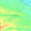
Obertraubling topographic map

Click on the map to display elevation.

About this map

Name: Obertraubling topographic map, elevation, terrain.

Location: Obertraubling, Landkreis Regensburg, Bavaria, 93083, Germany (48.92238 12.09541 48.97854 12.20005)

Average elevation: 359 m

Minimum elevation: 327 m

Maximum elevation: 425 m

Other topographic maps

Click on a map to view its topography, its elevation and its terrain.
Eggmühl

Germany > Bavaria > Landkreis Regensburg

Average elevation: 382 m

Wahlsdorf

Germany > Bavaria > Landkreis Regensburg

Average elevation: 435 m

Langenerling

Germany > Bavaria > Landkreis Regensburg

Average elevation: 355 m

Gear up for your next adventure:

🛶Waterproof Dry Bags - Keep electronics and clothes dry during river crossings
🥾Mountain Trail Shoes - High-traction shoes for mountain trails
🥾Mountain Hiking Boots - High-traction boots for rocky terrain
🥾Mountaineering Boots - Supportive boots for climbing and high-altitude hiking
🥾Hiking Gaiters - Protect legs and shoes from mud, snow, and debris

As an Amazon Associate, this site earns from qualifying purchases at no extra cost to you.