Geolocate

Oberstaufen topographic map

Click on the map to display elevation.

About this map

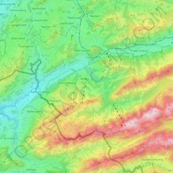
Name: Oberstaufen topographic map, elevation, terrain.

Location: Oberstaufen, Landkreis Oberallgäu, Bavaria, 87534, Germany (47.46563 9.95842 47.58342 10.16510)

Average elevation: 994 m

Minimum elevation: 557 m

Maximum elevation: 1,818 m

Gear up for your next adventure:

🎒Fully Waterproof Backpack - Total protection for photography gear and electronics
🧢Hiking Hat - Sun-protective and breathable hats for long treks
🛌Insulated Sleeping Pad - Critical thermal barrier between you and the cold ground
🧥Insulated Jacket - Keep warm in cold outdoor conditions
🥾Hiking Gaiters - Protect legs and shoes from mud, snow, and debris

As an Amazon Associate, this site earns from qualifying purchases at no extra cost to you.