Geolocate

Sevenoaks topographic map

Click on the map to display elevation.

About this map

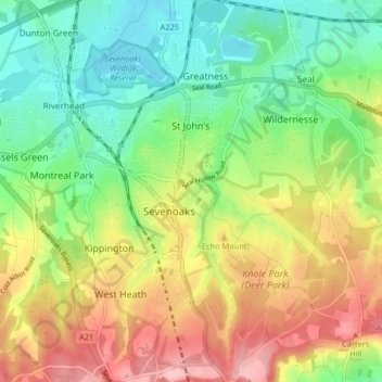
Name: Sevenoaks topographic map, elevation, terrain.

Location: Sevenoaks, Kent, England, United Kingdom (51.24917 0.17035 51.30013 0.22526)

Average elevation: 127 m

Minimum elevation: 62 m

Maximum elevation: 218 m

Gear up for your next adventure:

🧰Emergency Multi-Tool - Compact multi-tool for outdoor survival
🥾Hiking Boots - Sturdy boots providing ankle support and traction on rugged trails
🧣Evaporative Cooling Towel - Beat the heat during intense summer climbs
🥫Freeze-Dried Meals - Lightweight, high-calorie nutrition for multi-day treks
🧴Insect Repellent - Protect yourself from bugs during outdoor adventures

As an Amazon Associate, this site earns from qualifying purchases at no extra cost to you.