
Arad topographic map
Interactive map
Click on the map to display elevation.
About this map
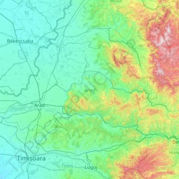
Name: Arad topographic map, elevation, terrain.
Location: Arad, Romania (45.90661 20.70425 46.68045 22.74644)
Average elevation: 296 m
Minimum elevation: 78 m
Maximum elevation: 1,828 m