Geolocate

Maffra topographic map

Click on the map to display elevation.

About this map

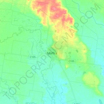
Name: Maffra topographic map, elevation, terrain.

Location: Maffra, Shire of Wellington, Victoria, 3860, Australia (-38.02131 146.93615 -37.90650 147.05868)

Average elevation: 31 m

Minimum elevation: 12 m

Maximum elevation: 84 m

Gear up for your next adventure:

Lightweight Camping Tent - Portable shelter optimized for Canadian backcountry camping
🦶Anti-Blister Balm - Prevents friction and hotspots during long ascents
🚲Bike Repair Kit - Essential tools for on-trail mechanical issues
🦌Outdoor Trail Camera - Monitor wildlife activity near your favorite spots
🏃Hydration Running Vest - Carry water and maps close to your body for speed

As an Amazon Associate, this site earns from qualifying purchases at no extra cost to you.