McLean topographic map
Click on the map to display elevation.
McLean
McLean is located at 38°56′03″N 77°10′39″W / 38.93417°N 77.17750°W / 38.93417; -77.17750 (38.9342776, −77.1774801) at an elevation of 285 feet (87 m). Located on the Capital Beltway (Interstate 495) in Northern Virginia, central McLean is 8 miles (13 km) northwest of downtown Washington, D.C., and 9 miles (14 km) northeast of Fairfax, the county seat.
About this map
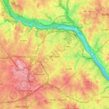
Name: McLean topographic map, elevation, terrain.
Location: McLean, Fairfax County, Virginia, United States (38.89325 -77.28782 38.97988 -77.11979)
Average elevation: 89 m
Minimum elevation: -2 m
Maximum elevation: 164 m
Other topographic maps
Click on a map to view its topography, its elevation and its terrain.