Geolocate

Opol topographic map

Click on the map to display elevation.

About this map

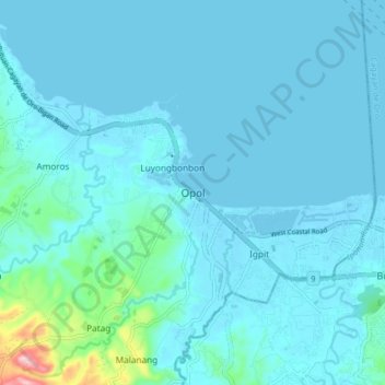
Name: Opol topographic map, elevation, terrain.

Location: Opol, Misamis Oriental, Northern Mindanao, 9016, Philippines (8.48128 124.53471 8.56128 124.61471)

Average elevation: 20 m

Minimum elevation: -4 m

Maximum elevation: 226 m

Other topographic maps

Click on a map to view its topography, its elevation and its terrain.

Gear up for your next adventure:

🧥Waterproof Jacket - Lightweight rain jackets for hiking and outdoor activities
🔭Compact Monocular - One-handed bird watching and trail spotting
🥾Hiking Shorts - Breathable shorts suitable for summer hikes
🥾Trekking Poles - Adjustable trekking poles to reduce knee stress and improve stability
📷Outdoor Action Camera - Capture high-elevation views and rugged adventures

As an Amazon Associate, this site earns from qualifying purchases at no extra cost to you.