Geolocate

Roccafluvione topographic map

Click on the map to display elevation.

About this map
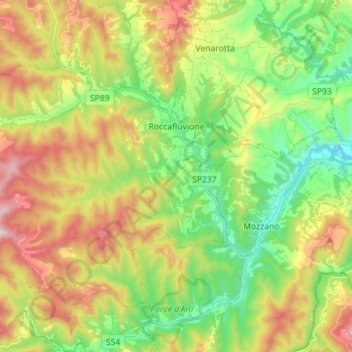
Name: Roccafluvione topographic map, elevation, terrain.

Location: Roccafluvione, Ascoli Piceno, Marche, 63093, Italy (42.79345 13.37433 42.89690 13.50048)

Average elevation: 448 m

Minimum elevation: 132 m

Maximum elevation: 921 m

Other topographic maps

Click on a map to view its topography, its elevation and its terrain.

Tronzano

Italy > Marche > Ascoli Piceno > Ascoli Piceno > Mozzano

Average elevation: 324 m

San Salvatore

Italy > Marche > Ascoli Piceno > Ripatransone

Average elevation: 185 m

Quinzano

Italy > Marche > Ascoli Piceno > Force > Quinzano

Average elevation: 583 m

Gear up for your next adventure:

🐕Hiking Dog Pack - Let your canine companion carry their own water and food
🥾Waterproof Hiking Boots - Essential footwear for rugged terrain and wet Canadian trails
⛺Bushcraft Tarp - Versatile emergency shelter or gear protection
🥾Hiking Shoes - Durable and comfortable shoes for trail hiking
🚲MTB Frame Bag - Carry tools and maps directly on your bicycle frame

As an Amazon Associate, this site earns from qualifying purchases at no extra cost to you.