Geolocate

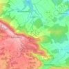
Wonsees topographic map

Click on the map to display elevation.

About this map

Name: Wonsees topographic map, elevation, terrain.

Location: Wonsees, Kasendorf (VGem), Landkreis Kulmbach, Bavaria, 96197, Germany (49.94334 11.25000 50.02343 11.37053)

Average elevation: 470 m

Minimum elevation: 381 m

Maximum elevation: 550 m

Other topographic maps

Click on a map to view its topography, its elevation and its terrain.
Buchau

Germany > Bavaria > Landkreis Kulmbach

Average elevation: 395 m

Lindenberg

Germany > Bavaria > Landkreis Kulmbach > Lopp

Average elevation: 427 m

Gear up for your next adventure:

🕯️Camping Lantern - Illuminates your entire campsite with high-efficiency LEDs
🥤Collapsible Travel Cup - Saves space and weight in your mess kit
🧴Bear Spray Holster - Quick-access carry for essential Canadian wilderness safety
🥾Hiking Boots - Sturdy boots providing ankle support and traction on rugged trails
🥾Light Trekking Boots - Supportive boots for multi-day treks

As an Amazon Associate, this site earns from qualifying purchases at no extra cost to you.