Geolocate

Brightlingsea topographic map

Click on the map to display elevation.

About this map
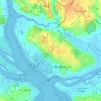
Name: Brightlingsea topographic map, elevation, terrain.

Location: Brightlingsea, Tendring, Essex, East of England, England, United Kingdom (51.80073 0.97901 51.83843 1.06576)

Average elevation: 8 m

Minimum elevation: -3 m

Maximum elevation: 31 m

Other topographic maps

Click on a map to view its topography, its elevation and its terrain.
Clacton-on-Sea

United Kingdom > England > Essex > Tendring

Average elevation: 7 m

Gear up for your next adventure:

🔦LED Headlamp - Hands-free lighting for early morning starts or late finishes
🛶Canoe Life Vest - Safety vest for water sports
🔭Compact Monocular - One-handed bird watching and trail spotting
🚲Handlebar Phone Mount - View topographic-map.com live while cycling
🧣Merino Neck Gaiter - Protects against wind, sun, and cold at high altitudes

As an Amazon Associate, this site earns from qualifying purchases at no extra cost to you.