Geolocate

Wigmore topographic map

Click on the map to display elevation.

About this map

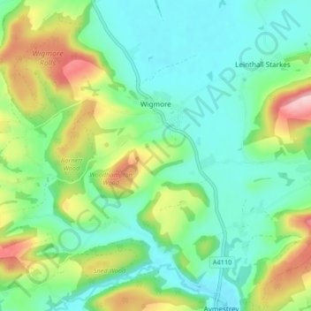
Name: Wigmore topographic map, elevation, terrain.

Location: Wigmore, Herefordshire, England, United Kingdom (52.28662 -2.92070 52.32821 -2.83849)

Average elevation: 167 m

Minimum elevation: 102 m

Maximum elevation: 321 m

Other topographic maps

Click on a map to view its topography, its elevation and its terrain.

Merryhill

United Kingdom > England > Herefordshire > Brinsop

Average elevation: 139 m

Gear up for your next adventure:

🦶Anti-Blister Balm - Prevents friction and hotspots during long ascents
🔭Outdoor Binoculars - Lightweight binoculars for birdwatching and hiking
💡Compact LED Flashlight - Powerful and portable flashlight for outdoor use
🥾Waterproof Trail Shoes - Shoes designed to handle wet terrain
🧥Softshell Jacket - Windproof and breathable jacket for hiking

As an Amazon Associate, this site earns from qualifying purchases at no extra cost to you.