
Thank you for supporting this site ❤️
Make a donation
Make a donation
Gear up for your next adventure:
As an Amazon Associate, this site earns from qualifying purchases at no extra cost to you.
Kaimosi topographic map
Click on the map to display elevation.
Thank you for supporting this site ❤️
Make a donation
Make a donation
Gear up for your next adventure:
As an Amazon Associate, this site earns from qualifying purchases at no extra cost to you.
About this map
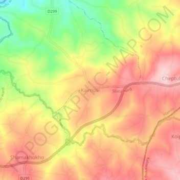
Name: Kaimosi topographic map, elevation, terrain.
Location: Kaimosi, Shiru ward, Hamisi, Vihiga County, Western, Kenya (0.10687 34.82621 0.14687 34.86621)
Average elevation: 1,647 m
Minimum elevation: 1,520 m
Maximum elevation: 1,732 m
Thank you for supporting this site ❤️
Make a donation
Make a donation
Gear up for your next adventure:
As an Amazon Associate, this site earns from qualifying purchases at no extra cost to you.