Geolocate

Lockhart topographic map

Click on the map to display elevation.

About this map
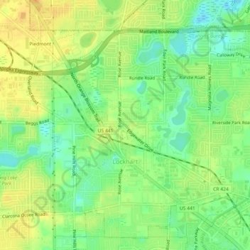
Name: Lockhart topographic map, elevation, terrain.

Location: Lockhart, Orange County, Florida, 32810, United States (28.61012 -81.45983 28.64019 -81.41486)

Average elevation: 30 m

Minimum elevation: 14 m

Maximum elevation: 43 m

Gear up for your next adventure:

🧦Hiking Socks - Moisture-wicking and comfortable socks for long hikes
🛁Quick-Dry Microfiber Towel - Space-saving towel that dries rapidly on the move
🧥Fleece Jacket - Warm and lightweight jacket for layering
🥾Trekking Poles - Adjustable trekking poles to reduce knee stress and improve stability
💧Hydration Bladder - Hands-free hydration solution for long treks

As an Amazon Associate, this site earns from qualifying purchases at no extra cost to you.