Geolocate

Bichl topographic map

Click on the map to display elevation.

About this map
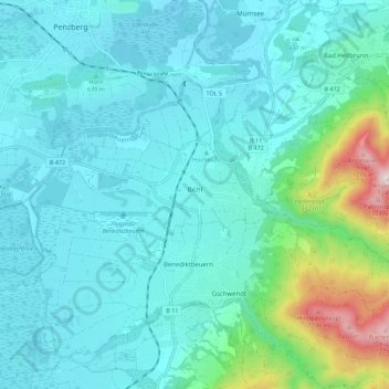
Name: Bichl topographic map, elevation, terrain.

Location: Bichl, Benediktbeuern (VGem), Landkreis Bad Tölz-Wolfratshausen, Bavaria, 83673, Germany (47.69720 11.37251 47.74170 11.48401)

Average elevation: 687 m

Minimum elevation: 581 m

Maximum elevation: 1,252 m

Other topographic maps

Click on a map to view its topography, its elevation and its terrain.

Gear up for your next adventure:

🧴Waterproofing Spray - Restore the DWR coating on jackets and tents
☕Camping Coffee Maker - Brew fresh coffee anywhere on the topographic map
🥾Hiking Gaiters - Protect legs and shoes from mud, snow, and debris
🏕️Camping Hammock - Integrated protection for sleeping between trees
🛌Down Sleeping Bag - Superior warmth-to-weight ratio for cold nights

As an Amazon Associate, this site earns from qualifying purchases at no extra cost to you.