Geolocate

Cavtat topographic map

Click on the map to display elevation.

About this map

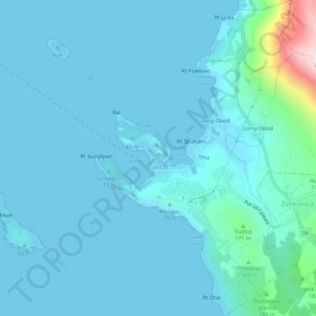
Name: Cavtat topographic map, elevation, terrain.

Location: Cavtat, Općina Konavle, Dubrovnik-Neretva County, Croatia (42.56425 18.20787 42.60060 18.25046)

Average elevation: 49 m

Minimum elevation: -1 m

Maximum elevation: 539 m

Gear up for your next adventure:

🧥Softshell Jacket - Windproof and breathable jacket for hiking
🥾Lightweight Hiking Boots - Boots for comfort and mobility on long hikes
🛏️Camping Sleeping Mat - Comfortable mats for sleeping outdoors
🛁Quick-Dry Microfiber Towel - Space-saving towel that dries rapidly on the move
🎒Fully Waterproof Backpack - Total protection for photography gear and electronics

As an Amazon Associate, this site earns from qualifying purchases at no extra cost to you.