
Make a donation
Gear up for your next adventure:
As an Amazon Associate, this site earns from qualifying purchases at no extra cost to you.
Municipio de Rada Tilly topographic map
Click on the map to display elevation.
Make a donation
Gear up for your next adventure:
As an Amazon Associate, this site earns from qualifying purchases at no extra cost to you.
Municipio de Rada Tilly
Rada Tilly features one of the longest Seabee seawalls in the world, comparable to that at Blackpool South Shore [UK], but comprising smaller units. The beach is very flat and is very wide at low tide. It is also quite dynamic, with back beach elevation varying by as much as 3m, depending on the season [as derived from photos on Panoramio]. The production techniques evolved by Corporacion Tecnologica Argentina produced over 500 units per shift.
Make a donation
Gear up for your next adventure:
As an Amazon Associate, this site earns from qualifying purchases at no extra cost to you.
About this map
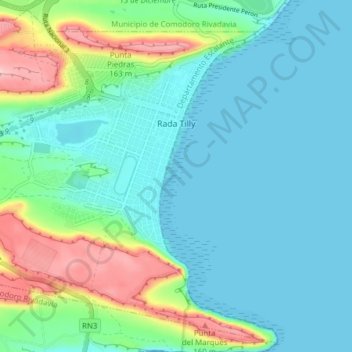
Name: Municipio de Rada Tilly topographic map, elevation, terrain.
Average elevation: 45 m
Minimum elevation: -1 m
Maximum elevation: 195 m
Make a donation
Gear up for your next adventure:
As an Amazon Associate, this site earns from qualifying purchases at no extra cost to you.
Other topographic maps
Click on a map to view its topography, its elevation and its terrain.