Geolocate

Sassari topographic map

Click on the map to display elevation.

About this map
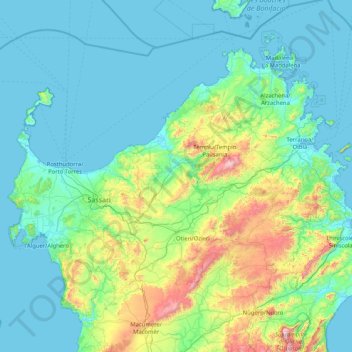
Name: Sassari topographic map, elevation, terrain.

Location: Sassari, Sardinia, Italy (40.29655 8.13084 41.31311 9.77936)

Average elevation: 199 m

Minimum elevation: -2 m

Maximum elevation: 1,431 m

Gear up for your next adventure:

⛺Camping Groundsheet - Protect your tent from moisture and dirt
🧥Waterproof Hiking Jacket - Protect yourself from rain and wind while hiking
🧊Portable Cooler - Keep food and drinks cold during outdoor adventures
🧢Outdoor Cap - Protective cap for sun and rain during hikes
🗺️Topographic Maps - Detailed maps to explore trails, mountains, and wilderness areas

As an Amazon Associate, this site earns from qualifying purchases at no extra cost to you.