
Thank you for supporting this site ❤️
Make a donation
Make a donation
Gear up for your next adventure:
As an Amazon Associate, this site earns from qualifying purchases at no extra cost to you.
Čiovo topographic map
Click on the map to display elevation.
Thank you for supporting this site ❤️
Make a donation
Make a donation
Gear up for your next adventure:
As an Amazon Associate, this site earns from qualifying purchases at no extra cost to you.
About this map
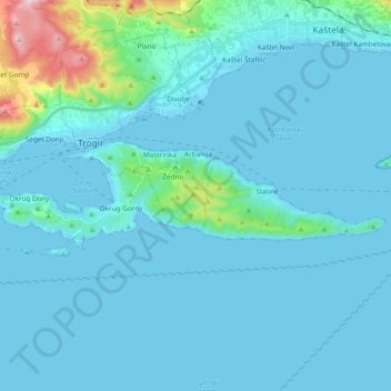
Name: Čiovo topographic map, elevation, terrain.
Location: Čiovo, Grad Trogir, Grad Split, Split-Dalmatia County, Croatia (43.47900 16.20311 43.51672 16.39220)
Average elevation: 46 m
Minimum elevation: -4 m
Maximum elevation: 516 m
Thank you for supporting this site ❤️
Make a donation
Make a donation
Gear up for your next adventure:
As an Amazon Associate, this site earns from qualifying purchases at no extra cost to you.