Geolocate

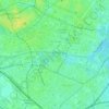
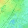
Strasbourg topographic map

Click on the map to display elevation.

About this map

Name: Strasbourg topographic map, elevation, terrain.

Location: Strasbourg, Bas-Rhin, European Collectivity of Alsace, Grand Est, Metropolitan France, France (48.49194 7.68814 48.64619 7.83606)

Average elevation: 144 m

Minimum elevation: 127 m

Maximum elevation: 194 m

Other topographic maps

Click on a map to view its topography, its elevation and its terrain.
le Champ du Feu

France > Grand Est > Bas-Rhin > Belmont

Average elevation: 945 m

Erstein-Gare

France > Grand Est > Bas-Rhin > Erstein

Average elevation: 154 m

Col du Donon

France > Grand Est > Bas-Rhin > Grandfontaine

Average elevation: 694 m

Graufthal

France > Grand Est > Bas-Rhin > Eschbourg

Average elevation: 290 m

Willigen

France > Grand Est > Bas-Rhin > Kilstett

Average elevation: 130 m

2te Gewann Neufeld

France > Grand Est > Bas-Rhin > Offendorf

Average elevation: 127 m

Grande Île

France > Grand Est > Bas-Rhin > Strasbourg

Average elevation: 145 m

Le Hang

France > Grand Est > Bas-Rhin > Bourg-Bruche

Average elevation: 580 m

Su

France > Grand Est > Bas-Rhin > Soultz-les-Bains

Average elevation: 207 m

Tête Pelée

France > Grand Est > Bas-Rhin > La Broque

Average elevation: 672 m

Kreutzel

France > Grand Est > Bas-Rhin > Baerendorf

Average elevation: 275 m

Gear up for your next adventure:

🛁Quick-Dry Microfiber Towel - Space-saving towel that dries rapidly on the move
🕶️Polarized Sunglasses - Reduces glare from snow and water at high elevations
💧Filtered Water Bottle - Safe drinking water on the go
🥫Freeze-Dried Meals - Lightweight, high-calorie nutrition for multi-day treks
🧢Hiking Sun Hat - Wide-brimmed protection for exposed mountain ridges

As an Amazon Associate, this site earns from qualifying purchases at no extra cost to you.