Geolocate

Greenacres topographic map

Click on the map to display elevation.

About this map

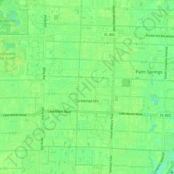
Name: Greenacres topographic map, elevation, terrain.

Location: Greenacres, Palm Beach County, Florida, United States (26.59261 -80.15765 26.66608 -80.11349)

Average elevation: 9 m

Minimum elevation: 1 m

Maximum elevation: 13 m

Other topographic maps

Click on a map to view its topography, its elevation and its terrain.

Gear up for your next adventure:

🍽️Titanium Camping Spork - Ultralight and indestructible eating utensil
🦶Hiking Shoe Insoles - Added support for high arches and long days on feet
💧Hydration Bladder - Hands-free hydration solution for long treks
Camping Essentials - All-in-one gear for a comfortable camping trip
🚲Heavy Duty Bike Lock - Secure your bike at the trailhead or during stops

As an Amazon Associate, this site earns from qualifying purchases at no extra cost to you.